Embark on a journey through York’s hidden past by exploring our interactive map of the city’s ghost signs.
Click here to access the map and uncover the stories behind each sign, leading you through the silent narratives that shape York’s rich history.
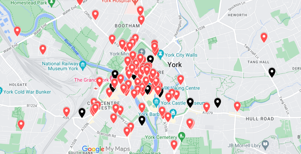
Red pointers highlight visible ghost signs, while black markers indicate those obscured or lost.
Click on a marker to learn the sign’s type—be it painted brick, metal, mosaic, or frosted glass—along with its imagery or text, and precise address.
We ensure marker accuracy, pinpointing not only the right wall of the building, but also the sign’s approximate position on that wall — which you can see if you zoom in.

Captivating ‘Ship Inn’ sign at 5 King’s Staith, now ‘Lil’s on The Waterfront’
*
Spotted a ghost sign not on our map? We want to hear from you! Dive deeper into York’s story by sharing your discovery with us in the comments section.
*
One at the rear of 68 Gillygate if i remember correctly.(osbornes cafe)
Hello there. I thought you might be interested to know that my great uncle John Edward Enderby and his sister Minnie Waller Alves, nee Enderby lived at 102 Walmgate between about 1891 and 1895-9. John’s occupation is listed in Whites Directory of York as a Druggist, which completely makes sense, given the current facia says Chemist. He married Kate Cammack in 1892 in York.
I haven’t been able to discover when or why John left York and moved to Horncastle, Lincs, but his sister Minnie is recorded living back in Spalding, Lincs (where the family came from) in 1895.